1.3 million
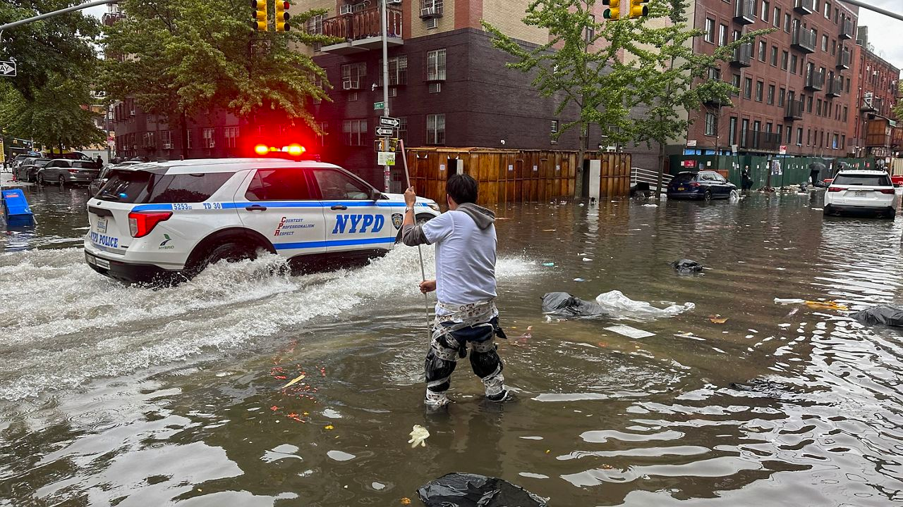
New York City residents live within or directly adjacent to the floodplain. Flood damage is extensive, expensive, and often times predictable
Source: Info, Photo
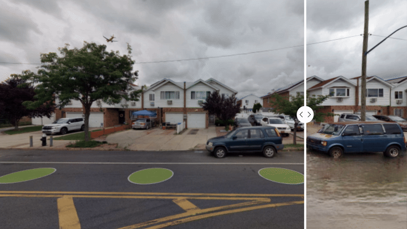
Maps of predicted flooding are helpful planning tools, but aerial views distance viewers from its potential impact
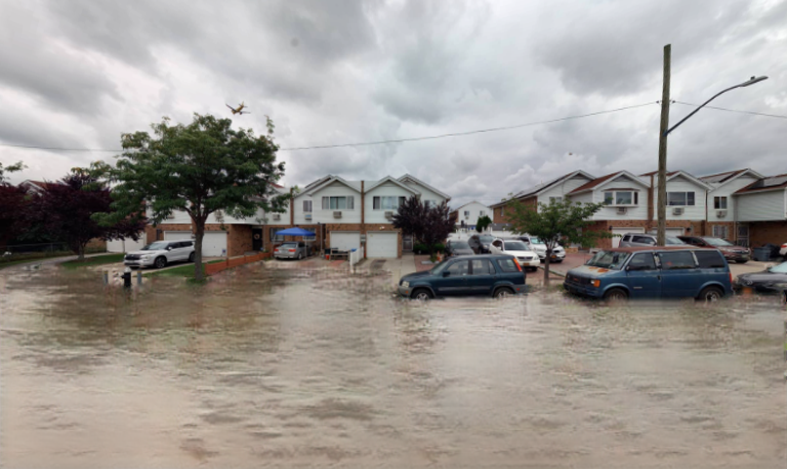
If we show the reality of predicted flooding through photorealistic imagery, could people be more prepared?
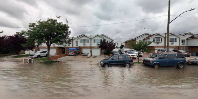
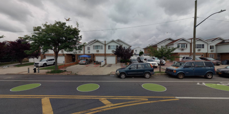
FloodGen uses AI to generate photorealistic images of potential flooding scenarios to raise awareness, bolster community preparedness, and support local governments resilience strategies.
Today, 1.3 million New York City residents live within or directly adjacent to the floodplain.1 Flood damage is expensive, extensive, and oftentimes predictable. Maps of predicted flooding are helpful planning tools, but aerial views distance viewers from its potential impact. If we show the reality of predicted flooding through photorealistic imagery, could people be more prepared?
FloodGen is an advocacy tool that uses generative artificial intelligence (GenAI) to create photorealistic images of predicted flooding. Projected flood imagery from FloodGen can be integrated within community engagement strategies to:
- 1. raise awareness for communities who have not yet experienced flooding,
- 2. create evidence for communities seeking resilience funding and projects
- 3. respond to resilience advocacy efforts by municipal government agents and decision makers
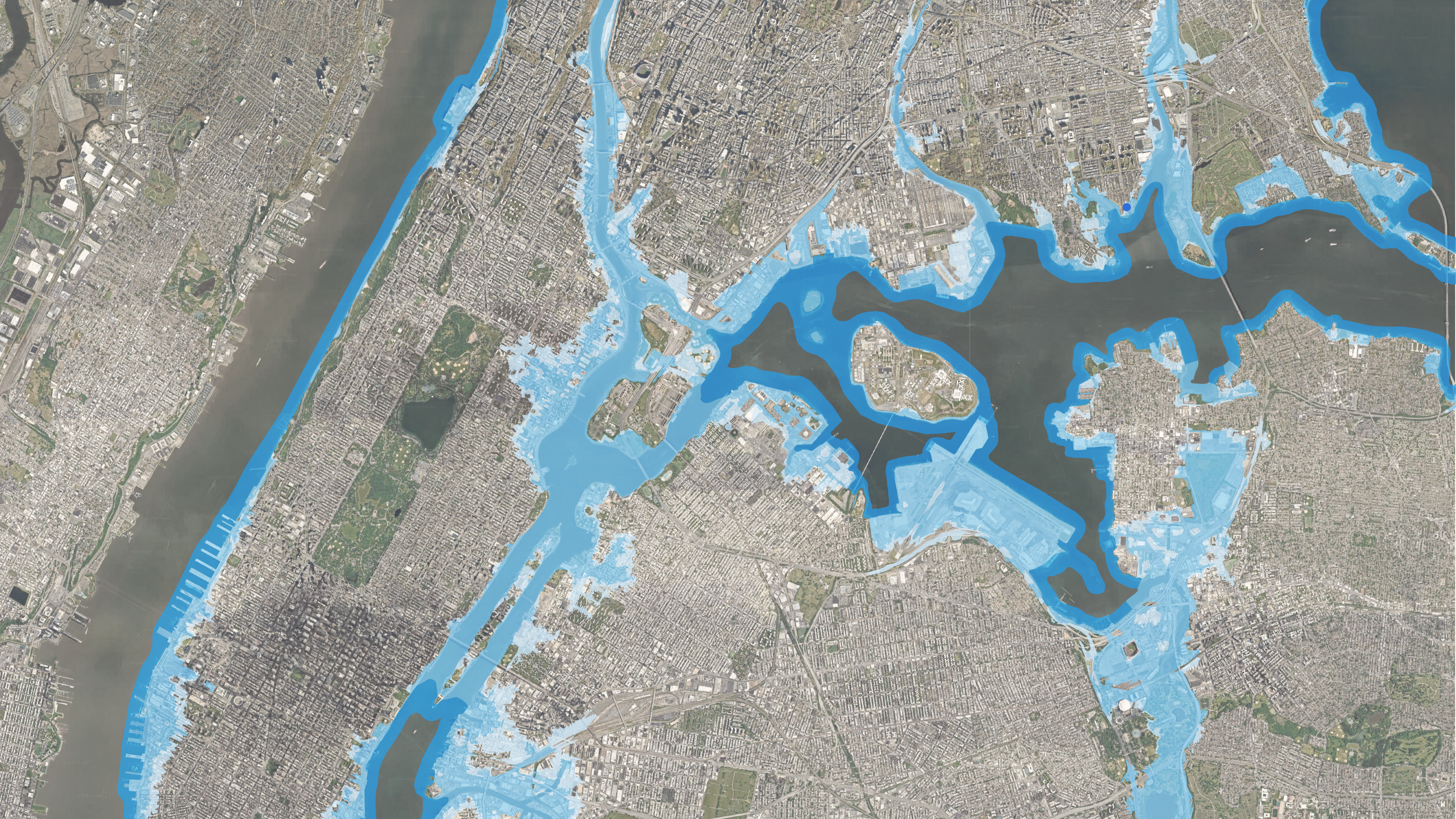
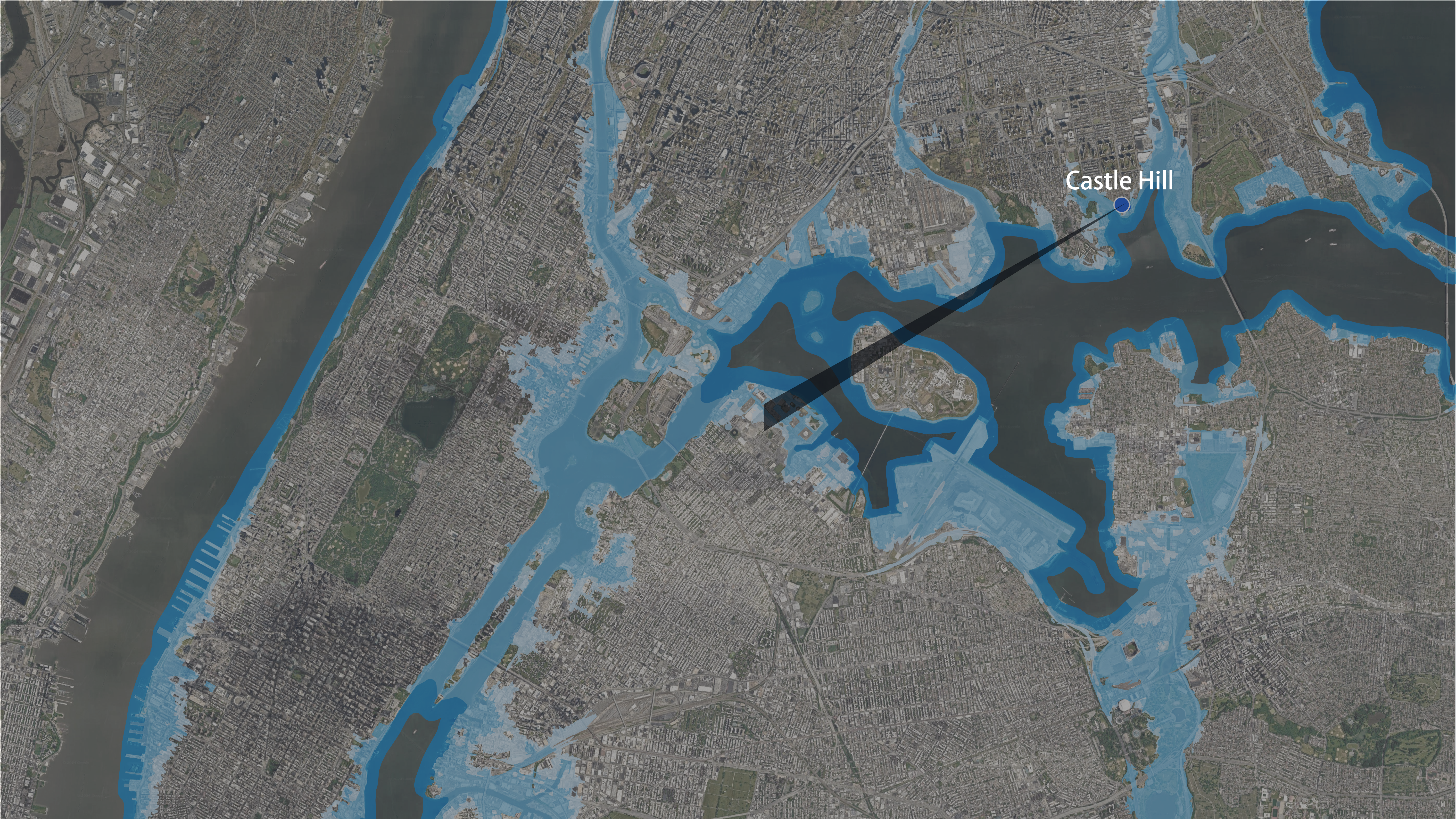
This website demonstrates the potential to position FloodGen as an advocacy tool. FloodGen features an interactive web map that contextualizes flood risk and AI generated imagery of predicted flooding for ten case study sites in New York City. The case study sites were selected based on flood risk hazards of coastal and stormwater flooding, vulnerability of environmental justice areas and hurricane evacuation zones, and exposure to nearby points of interest, including nearby transit, public housing, hospitals, commercial areas, schools, and libraries.
Explore flood prone neighborhoods in the map and AI generated imagery of street views with projected flooding.
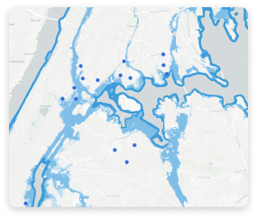
Explore flood prone neighborhoods in NYC